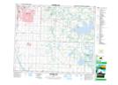
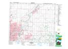
Maps showing Whitecroft, 23-52-23-W4, Alberta
Whitecroft is a Unincorporated area located in 23-52-23-W4, Alberta and has an elevation of 745 meters.
- Latitude: 53° 30' 6'' North (decimal: 53.5016666)
- Longitude: 113° 17' 35'' West (decimal: -113.2930555)
- Topography Feature Category: Unincorporated area
- Geographical Feature: Hamlet
- Canadian Province/Territory: Alberta
- Elevation: 745 meters
- Location: 23-52-23-W4
- Atlas of Canada Locator Map: Whitecroft
- GPS Coordinate Locator Map: Whitecroft Lat/Long
Whitecroft NTS Map Sheets