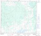
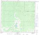
Maps showing Whitemud Hills, 85-25-W5, Alberta
Whitemud Hills is a Mountain located in 85-25-W5, Alberta and has an elevation of 754 meters.
- Latitude: 56° 22' North (decimal: 56.3666666)
- Longitude: 117° 55' West (decimal: -117.9166666)
- Topography Feature Category: Mountain
- Geographical Feature: Hills
- Canadian Province/Territory: Alberta
- Elevation: 754 meters
- Location: 85-25-W5
- Atlas of Canada Locator Map: Whitemud Hills
- GPS Coordinate Locator Map: Whitemud Hills Lat/Long
Whitemud Hills NTS Map Sheets