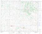
Maps showing Whitewater Lake, 10-45-13-W4, Alberta
Whitewater Lake is a Lake located in 10-45-13-W4, Alberta and has an elevation of 664 meters.
- Latitude: 52° 51' 34'' North (decimal: 52.8594444)
- Longitude: 111° 47' 38'' West (decimal: -111.7938889)
- Topography Feature Category: Lake
- Geographical Feature: Lake
- Canadian Province/Territory: Alberta
- Elevation: 664 meters
- Location: 10-45-13-W4
- Atlas of Canada Locator Map: Whitewater Lake
- GPS Coordinate Locator Map: Whitewater Lake Lat/Long
Whitewater Lake NTS Map Sheets