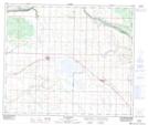
Maps showing Whitford Lake, 56-15,16-W4, Alberta
Whitford Lake is a Lake located in 56-15,16-W4, Alberta and has an elevation of 624 meters.
- Latitude: 53° 51' 27'' North (decimal: 53.8575000)
- Longitude: 112° 15' 47'' West (decimal: -112.2630556)
- Topography Feature Category: Lake
- Geographical Feature: Lake
- Canadian Province/Territory: Alberta
- Elevation: 624 meters
- Location: 56-15,16-W4
- Atlas of Canada Locator Map: Whitford Lake
- GPS Coordinate Locator Map: Whitford Lake Lat/Long
Whitford Lake NTS Map Sheets