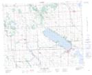
Maps showing Jarvis Bay Provincial Park, 39-1-W5, Alberta
Jarvis Bay Provincial Park is a Conservation area located in 39-1-W5, Alberta and has an elevation of 957 meters.
- Latitude: 52° 20' 43'' North (decimal: 52.3452777)
- Longitude: 114° 5' 11'' West (decimal: -114.0863888)
- Topography Feature Category: Conservation area
- Geographical Feature: Provincial Park
- Canadian Province/Territory: Alberta
- Elevation: 957 meters
- Location: 39-1-W5
- Atlas of Canada Locator Map: Jarvis Bay Provincial Park
- GPS Coordinate Locator Map: Jarvis Bay Provincial Park Lat/Long
Jarvis Bay Provincial Park NTS Map Sheets