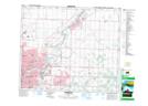
Maps showing Weir Industrial, Alberta
Weir Industrial is a Unincorporated area located in Alberta and has an elevation of 679 meters.
- Latitude: 53° 30' 44'' North (decimal: 53.5122222)
- Longitude: 113° 24' 20'' West (decimal: -113.4055556)
- Topography Feature Category: Unincorporated area
- Geographical Feature: Urban Community
- Canadian Province/Territory: Alberta
- Elevation: 679 meters
- Atlas of Canada Locator Map: Weir Industrial
- GPS Coordinate Locator Map: Weir Industrial Lat/Long