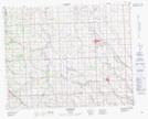
Maps showing Westcott, 35-30-3-W5, Alberta
Westcott is a Unincorporated area located in 35-30-3-W5, Alberta and has an elevation of 1058 meters.
- Latitude: 51° 37' 13'' North (decimal: 51.6202777)
- Longitude: 114° 19' 21'' West (decimal: -114.3224999)
- Topography Feature Category: Unincorporated area
- Geographical Feature: Locality
- Canadian Province/Territory: Alberta
- Elevation: 1058 meters
- Location: 35-30-3-W5
- Atlas of Canada Locator Map: Westcott
- GPS Coordinate Locator Map: Westcott Lat/Long