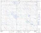
Maps showing West Wingham, 25-32-11-W4, Alberta
West Wingham is a Unincorporated area located in 25-32-11-W4, Alberta.
- Latitude: 51° 46' North (decimal: 51.7666999)
- Longitude: 111° 26' West (decimal: -111.4332999)
- Topography Feature Category: Unincorporated area
- Geographical Feature: Post Office
- Canadian Province/Territory: Alberta
- Location: 25-32-11-W4
- GPS Coordinate Locator Map: West Wingham Lat/Long
West Wingham NTS Map Sheets