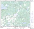
Maps showing Willow Trail, 6-64-6-W4, Alberta
Willow Trail is a Unincorporated area located in 6-64-6-W4, Alberta.
- Latitude: 54° 30' North (decimal: 54.5000000)
- Longitude: 110° 56' West (decimal: -110.9332999)
- Topography Feature Category: Unincorporated area
- Geographical Feature: Locality
- Canadian Province/Territory: Alberta
- Location: 6-64-6-W4
- GPS Coordinate Locator Map: Willow Trail Lat/Long
Willow Trail NTS Map Sheets