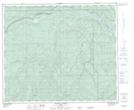
Maps showing Windfall, 17-60-15-W5, Alberta
Windfall is a Unincorporated area located in 17-60-15-W5, Alberta and has an elevation of 809 meters.
- Latitude: 54° 11' 00'' North (decimal: 54.1833333)
- Longitude: 116° 12' 39'' West (decimal: -116.2108332)
- Topography Feature Category: Unincorporated area
- Geographical Feature: Hamlet
- Canadian Province/Territory: Alberta
- Elevation: 809 meters
- Location: 17-60-15-W5
- Atlas of Canada Locator Map: Windfall
- GPS Coordinate Locator Map: Windfall Lat/Long
Windfall NTS Map Sheets