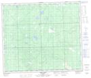
Maps showing Windfall Lake, 66-5-W5, Alberta
Windfall Lake is a Lake located in 66-5-W5, Alberta and has an elevation of 758 meters.
- Latitude: 54° 43' 2'' North (decimal: 54.7172221)
- Longitude: 114° 44' 46'' West (decimal: -114.7461111)
- Topography Feature Category: Lake
- Geographical Feature: Lake
- Canadian Province/Territory: Alberta
- Elevation: 758 meters
- Location: 66-5-W5
- Atlas of Canada Locator Map: Windfall Lake
- GPS Coordinate Locator Map: Windfall Lake Lat/Long
Windfall Lake NTS Map Sheets