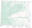
Maps showing Windsor Creek, 31-70-12-W6, Alberta
Windsor Creek is a Unincorporated area located in 31-70-12-W6, Alberta.
- Latitude: 55° 6' North (decimal: 55.1000000)
- Longitude: 119° 49' West (decimal: -119.8167000)
- Topography Feature Category: Unincorporated area
- Geographical Feature: Locality
- Canadian Province/Territory: Alberta
- Location: 31-70-12-W6
- GPS Coordinate Locator Map: Windsor Creek Lat/Long
Windsor Creek NTS Map Sheets