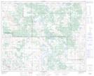
Maps showing Willow Lake, 11-43-6-W4, Alberta
Willow Lake is a Lake located in 11-43-6-W4, Alberta and has an elevation of 655 meters.
- Latitude: 52° 41' 13'' North (decimal: 52.6869444)
- Longitude: 110° 45' 46'' West (decimal: -110.7627777)
- Topography Feature Category: Lake
- Geographical Feature: Lake
- Canadian Province/Territory: Alberta
- Elevation: 655 meters
- Location: 11-43-6-W4
- Atlas of Canada Locator Map: Willow Lake
- GPS Coordinate Locator Map: Willow Lake Lat/Long
Willow Lake NTS Map Sheets