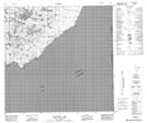
Maps showing Winnifred Lake, 118-3-W4, Alberta
Winnifred Lake is a Lake located in 118-3-W4, Alberta and has an elevation of 301 meters.
- Latitude: 59° 13' 53'' North (decimal: 59.2313888)
- Longitude: 110° 24' 22'' West (decimal: -110.4061111)
- Topography Feature Category: Lake
- Geographical Feature: Lake
- Canadian Province/Territory: Alberta
- Elevation: 301 meters
- Location: 118-3-W4
- Atlas of Canada Locator Map: Winnifred Lake
- GPS Coordinate Locator Map: Winnifred Lake Lat/Long
Winnifred Lake NTS Map Sheets