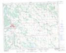
Maps showing Withrow, 28-39-4-W5, Alberta
Withrow is a Unincorporated area located in 28-39-4-W5, Alberta and has an elevation of 966 meters.
- Latitude: 52° 23' North (decimal: 52.3832999)
- Longitude: 114° 30' West (decimal: -114.4999999)
- Topography Feature Category: Unincorporated area
- Geographical Feature: Railway Point
- Canadian Province/Territory: Alberta
- Elevation: 966 meters
- Location: 28-39-4-W5
- Atlas of Canada Locator Map: Withrow
- GPS Coordinate Locator Map: Withrow Lat/Long
Withrow NTS Map Sheets