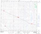
Maps showing Daysland, 9-45-16-W4, Alberta
Daysland is a Town located in 9-45-16-W4, Alberta and has an elevation of 711 meters.
- Latitude: 52° 51' 51'' North (decimal: 52.8641666)
- Longitude: 112° 15' 18'' West (decimal: -112.2550000)
- Topography Feature Category: Town
- Geographical Feature: Town
- Canadian Province/Territory: Alberta
- Elevation: 711 meters
- Location: 9-45-16-W4
- Atlas of Canada Locator Map: Daysland
- GPS Coordinate Locator Map: Daysland Lat/Long