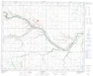
Maps showing Paintearth Creek, 4-40-13-W4, Alberta
Paintearth Creek is a River located in 4-40-13-W4, Alberta and has an elevation of 670 meters.
- Latitude: 52° 24' 33'' North (decimal: 52.4091666)
- Longitude: 111° 49' 15'' West (decimal: -111.8208332)
- Topography Feature Category: River
- Geographical Feature: Creek
- Canadian Province/Territory: Alberta
- Elevation: 670 meters
- Location: 4-40-13-W4
- Atlas of Canada Locator Map: Paintearth Creek
- GPS Coordinate Locator Map: Paintearth Creek Lat/Long
Paintearth Creek NTS Map Sheets