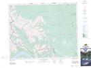
Maps showing Pakakos Mountain, 16-27-10-W5, Alberta
Pakakos Mountain is a Mountain located in 16-27-10-W5, Alberta and has an elevation of 2241 meters.
- Latitude: 51° 18' 13'' North (decimal: 51.3036110)
- Longitude: 115° 20' 37'' West (decimal: -115.3436110)
- Topography Feature Category: Mountain
- Geographical Feature: Mountain
- Canadian Province/Territory: Alberta
- Elevation: 2241 meters
- Location: 16-27-10-W5
- Atlas of Canada Locator Map: Pakakos Mountain
- GPS Coordinate Locator Map: Pakakos Mountain Lat/Long
Pakakos Mountain NTS Map Sheets