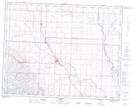
Maps showing Parkland, 16-15-27-W4, Alberta
Parkland is a Unincorporated area located in 16-15-27-W4, Alberta and has an elevation of 1062 meters.
- Latitude: 50° 15' 22'' North (decimal: 50.2561111)
- Longitude: 113° 39' 31'' West (decimal: -113.6586110)
- Topography Feature Category: Unincorporated area
- Geographical Feature: Hamlet
- Canadian Province/Territory: Alberta
- Elevation: 1062 meters
- Location: 16-15-27-W4
- Atlas of Canada Locator Map: Parkland
- GPS Coordinate Locator Map: Parkland Lat/Long