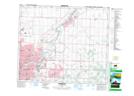
Maps showing Partridge Hill, 54-21,22-W4, Alberta
Partridge Hill is a Unincorporated area located in 54-21,22-W4, Alberta and has an elevation of 673 meters.
- Latitude: 53° 39' 25'' North (decimal: 53.6569444)
- Longitude: 113° 5' 51'' West (decimal: -113.0974999)
- Topography Feature Category: Unincorporated area
- Geographical Feature: Former Locality
- Canadian Province/Territory: Alberta
- Elevation: 673 meters
- Location: 54-21,22-W4
- Atlas of Canada Locator Map: Partridge Hill
- GPS Coordinate Locator Map: Partridge Hill Lat/Long