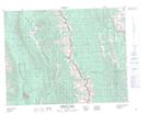
Maps showing Pasque Mountain, 14-5-W5, Alberta
Pasque Mountain is a Mountain located in 14-5-W5, Alberta and has an elevation of 2376 meters.
- Latitude: 50° 9' 28'' North (decimal: 50.1577777)
- Longitude: 114° 35' 56'' West (decimal: -114.5988888)
- Topography Feature Category: Mountain
- Geographical Feature: Mountain
- Canadian Province/Territory: Alberta
- Elevation: 2376 meters
- Location: 14-5-W5
- Atlas of Canada Locator Map: Pasque Mountain
- GPS Coordinate Locator Map: Pasque Mountain Lat/Long
Pasque Mountain NTS Map Sheets