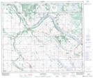
Maps showing Lac Patenaude, 15-55-1-W4, Alberta
Lac Patenaude is a Lake located in 15-55-1-W4, Alberta and has an elevation of 603 meters.
- Latitude: 53° 44' 43'' North (decimal: 53.7452777)
- Longitude: 110° 3' 50'' West (decimal: -110.0638888)
- Topography Feature Category: Lake
- Geographical Feature: Lac
- Canadian Province/Territory: Alberta
- Elevation: 603 meters
- Location: 15-55-1-W4
- Atlas of Canada Locator Map: Lac Patenaude
- GPS Coordinate Locator Map: Lac Patenaude Lat/Long