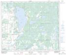
Maps showing Paterson Lake, 55-3,4-W4, Alberta
Paterson Lake is a Lake located in 55-3,4-W4, Alberta and has an elevation of 563 meters.
- Latitude: 53° 47' 13'' North (decimal: 53.7869444)
- Longitude: 110° 27' 2'' West (decimal: -110.4505555)
- Topography Feature Category: Lake
- Geographical Feature: Lake
- Canadian Province/Territory: Alberta
- Elevation: 563 meters
- Location: 55-3,4-W4
- Atlas of Canada Locator Map: Paterson Lake
- GPS Coordinate Locator Map: Paterson Lake Lat/Long
Paterson Lake NTS Map Sheets