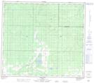
Maps showing Deer Hill, 13-84-3-W6, Alberta
Deer Hill is a Unincorporated area located in 13-84-3-W6, Alberta and has an elevation of 680 meters.
- Latitude: 56° 17' 4'' North (decimal: 56.2844444)
- Longitude: 118° 20' 46'' West (decimal: -118.3461111)
- Topography Feature Category: Unincorporated area
- Geographical Feature: Locality
- Canadian Province/Territory: Alberta
- Elevation: 680 meters
- Location: 13-84-3-W6
- Atlas of Canada Locator Map: Deer Hill
- GPS Coordinate Locator Map: Deer Hill Lat/Long
Deer Hill NTS Map Sheets