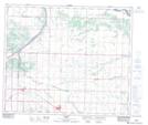
Maps showing Deerland, 2-57-20-W4, Alberta
Deerland is a Unincorporated area located in 2-57-20-W4, Alberta and has an elevation of 622 meters.
- Latitude: 53° 53' 44'' North (decimal: 53.8955555)
- Longitude: 112° 51' 8'' West (decimal: -112.8522221)
- Topography Feature Category: Unincorporated area
- Geographical Feature: Locality
- Canadian Province/Territory: Alberta
- Elevation: 622 meters
- Location: 2-57-20-W4
- Atlas of Canada Locator Map: Deerland
- GPS Coordinate Locator Map: Deerland Lat/Long