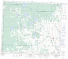
Maps showing Demmitt, 35-74-13-W6, Alberta
Demmitt is a Unincorporated area located in 35-74-13-W6, Alberta and has an elevation of 822 meters.
- Latitude: 55° 27' 20'' North (decimal: 55.4555555)
- Longitude: 119° 53' 48'' West (decimal: -119.8966667)
- Topography Feature Category: Unincorporated area
- Geographical Feature: Locality
- Canadian Province/Territory: Alberta
- Elevation: 822 meters
- Location: 35-74-13-W6
- Atlas of Canada Locator Map: Demmitt
- GPS Coordinate Locator Map: Demmitt Lat/Long
Demmitt NTS Map Sheets