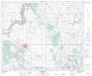
Maps showing Denwood, 25-44-7-W4, Alberta
Denwood is a Unincorporated area located in 25-44-7-W4, Alberta.
- Latitude: 52° 49' 11'' North (decimal: 52.8197221)
- Longitude: 110° 53' 40'' West (decimal: -110.8944443)
- Topography Feature Category: Unincorporated area
- Geographical Feature: Post Office
- Canadian Province/Territory: Alberta
- Location: 25-44-7-W4
- Atlas of Canada Locator Map: Denwood
- GPS Coordinate Locator Map: Denwood Lat/Long
Denwood NTS Map Sheets