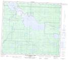
Maps showing Desmarais, 80-25-W4, Alberta
Desmarais is a Unincorporated area located in 80-25-W4, Alberta and has an elevation of 551 meters.
- Latitude: 55° 58' North (decimal: 55.9666999)
- Longitude: 113° 51' West (decimal: -113.8499999)
- Topography Feature Category: Unincorporated area
- Geographical Feature: Hamlet
- Canadian Province/Territory: Alberta
- Elevation: 551 meters
- Location: 80-25-W4
- GPS Coordinate Locator Map: Desmarais Lat/Long
Desmarais NTS Map Sheets