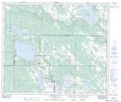
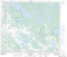
Maps showing Desmaw Lake, 1-64-14-W4, Alberta
Desmaw Lake is a Lake located in 1-64-14-W4, Alberta and has an elevation of 606 meters.
- Latitude: 54° 30' 18'' North (decimal: 54.5050000)
- Longitude: 111° 58' 43'' West (decimal: -111.9786111)
- Topography Feature Category: Lake
- Geographical Feature: Lake
- Canadian Province/Territory: Alberta
- Elevation: 606 meters
- Location: 1-64-14-W4
- Atlas of Canada Locator Map: Desmaw Lake
- GPS Coordinate Locator Map: Desmaw Lake Lat/Long
Desmaw Lake NTS Map Sheets