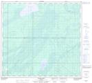
Maps showing Kearl Lake, 95,96-8-W4, Alberta
Kearl Lake is a Lake located in 95,96-8-W4, Alberta and has an elevation of 322 meters.
- Latitude: 57° 17' 38'' North (decimal: 57.2938888)
- Longitude: 111° 14' 17'' West (decimal: -111.2380555)
- Topography Feature Category: Lake
- Geographical Feature: Lake
- Canadian Province/Territory: Alberta
- Elevation: 322 meters
- Location: 95,96-8-W4
- Atlas of Canada Locator Map: Kearl Lake
- GPS Coordinate Locator Map: Kearl Lake Lat/Long
Kearl Lake NTS Map Sheets