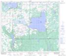
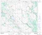
Maps showing Kehiwin Creek, 32-59-7-W4, Alberta
Kehiwin Creek is a River located in 32-59-7-W4, Alberta and has an elevation of 568 meters.
- Latitude: 54° 8' 37'' North (decimal: 54.1436110)
- Longitude: 111° 0' 27'' West (decimal: -111.0075000)
- Topography Feature Category: River
- Geographical Feature: Creek
- Canadian Province/Territory: Alberta
- Elevation: 568 meters
- Location: 32-59-7-W4
- Atlas of Canada Locator Map: Kehiwin Creek
- GPS Coordinate Locator Map: Kehiwin Creek Lat/Long
Kehiwin Creek NTS Map Sheets