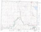
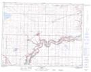
Maps showing Keho Lake, 11-22,23-W4, Alberta
Keho Lake is a Lake located in 11-22,23-W4, Alberta and has an elevation of 961 meters.
- Latitude: 49° 56' 52'' North (decimal: 49.9477778)
- Longitude: 113° 0' 18'' West (decimal: -113.0049999)
- Topography Feature Category: Lake
- Geographical Feature: Lake
- Canadian Province/Territory: Alberta
- Elevation: 961 meters
- Location: 11-22,23-W4
- Atlas of Canada Locator Map: Keho Lake
- GPS Coordinate Locator Map: Keho Lake Lat/Long
Keho Lake NTS Map Sheets