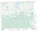
Maps showing Alder Flats, 4-46-7-W5, Alberta
Alder Flats is a Unincorporated area located in 4-46-7-W5, Alberta and has an elevation of 949 meters.
- Latitude: 52° 55' 59'' North (decimal: 52.9330555)
- Longitude: 114° 57' 25'' West (decimal: -114.9569444)
- Topography Feature Category: Unincorporated area
- Geographical Feature: Hamlet
- Canadian Province/Territory: Alberta
- Elevation: 949 meters
- Location: 4-46-7-W5
- Atlas of Canada Locator Map: Alder Flats
- GPS Coordinate Locator Map: Alder Flats Lat/Long
Alder Flats NTS Map Sheets