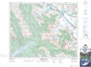
Maps showing Alexandra Glaciers, 35-22,23-W5, Alberta
Alexandra Glaciers is a Glacier located in 35-22,23-W5, Alberta and has an elevation of 2148 meters.
- Latitude: 51° 59' 7'' North (decimal: 51.9852778)
- Longitude: 117° 8' 54'' West (decimal: -117.1483333)
- Topography Feature Category: Glacier
- Geographical Feature: Glaciers
- Canadian Province/Territory: Alberta
- Elevation: 2148 meters
- Location: 35-22,23-W5
- Atlas of Canada Locator Map: Alexandra Glaciers
- GPS Coordinate Locator Map: Alexandra Glaciers Lat/Long
Alexandra Glaciers NTS Map Sheets