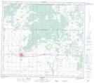
Maps showing Alex Lake, 14-82-3-W6, Alberta
Alex Lake is a Lake located in 14-82-3-W6, Alberta and has an elevation of 680 meters.
- Latitude: 56° 6' 54'' North (decimal: 56.1150000)
- Longitude: 118° 20' 33'' West (decimal: -118.3425000)
- Topography Feature Category: Lake
- Geographical Feature: Lake
- Canadian Province/Territory: Alberta
- Elevation: 680 meters
- Location: 14-82-3-W6
- Atlas of Canada Locator Map: Alex Lake
- GPS Coordinate Locator Map: Alex Lake Lat/Long
Alex Lake NTS Map Sheets