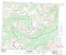
Maps showing Mount Pauline, 52-13-W6, Alberta
Mount Pauline is a Mountain located in 52-13-W6, Alberta and has an elevation of 2298 meters.
- Latitude: 53° 32' 5'' North (decimal: 53.5346999)
- Longitude: 119° 53' 51'' West (decimal: -119.8975000)
- Topography Feature Category: Mountain
- Geographical Feature: Mount
- Canadian Province/Territory: Alberta
- Elevation: 2298 meters
- Location: 52-13-W6
- Atlas of Canada Locator Map: Mount Pauline
- GPS Coordinate Locator Map: Mount Pauline Lat/Long
Mount Pauline NTS Map Sheets