Maps showing Paxton Lake, 107-5-W4, Alberta
Paxton Lake is a Lake located in 107-5-W4, Alberta and has an elevation of 286 meters.
- Latitude: 58° 15' 39'' North (decimal: 58.2608000)
- Longitude: 110° 42' 21'' West (decimal: -110.7058000)
- Topography Feature Category: Lake
- Geographical Feature: Lake
- Canadian Province/Territory: Alberta
- Elevation: 286 meters
- Location: 107-5-W4
- Atlas of Canada Locator Map: Paxton Lake
- GPS Coordinate Locator Map: Paxton Lake Lat/Long
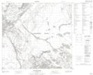
Paxton Lake NTS Map Sheets