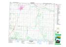
Maps showing Peace Hills, 46-24-W4, Alberta
Peace Hills is a Mountain located in 46-24-W4, Alberta and has an elevation of 769 meters.
- Latitude: 52° 59' 21'' North (decimal: 52.9891999)
- Longitude: 113° 24' 20'' West (decimal: -113.4056000)
- Topography Feature Category: Mountain
- Geographical Feature: Hills
- Canadian Province/Territory: Alberta
- Elevation: 769 meters
- Location: 46-24-W4
- Atlas of Canada Locator Map: Peace Hills
- GPS Coordinate Locator Map: Peace Hills Lat/Long
Peace Hills NTS Map Sheets