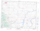
Maps showing Pecten, 21-4-30-W4, Alberta
Pecten is a Unincorporated area located in 21-4-30-W4, Alberta and has an elevation of 1475 meters.
- Latitude: 49° 18' 21'' North (decimal: 49.3058333)
- Longitude: 113° 59' 25'' West (decimal: -113.9902777)
- Topography Feature Category: Unincorporated area
- Geographical Feature: Locality
- Canadian Province/Territory: Alberta
- Elevation: 1475 meters
- Location: 21-4-30-W4
- Atlas of Canada Locator Map: Pecten
- GPS Coordinate Locator Map: Pecten Lat/Long
Pecten NTS Map Sheets