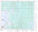
Maps showing Pelican Island, 67-13-W4, Alberta
Pelican Island is a Island located in 67-13-W4, Alberta.
- Latitude: 54° 51' 58'' North (decimal: 54.8661111)
- Longitude: 111° 57' 46'' West (decimal: -111.9627778)
- Topography Feature Category: Island
- Geographical Feature: Island
- Canadian Province/Territory: Alberta
- Location: 67-13-W4
- Atlas of Canada Locator Map: Pelican Island
- GPS Coordinate Locator Map: Pelican Island Lat/Long
Pelican Island NTS Map Sheets