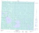
Maps showing Pelican Lake, 78,79-21,22-W4, Alberta
Pelican Lake is a Lake located in 78,79-21,22-W4, Alberta and has an elevation of 550 meters.
- Latitude: 55° 48' 23'' North (decimal: 55.8063889)
- Longitude: 113° 15' 30'' West (decimal: -113.2583332)
- Topography Feature Category: Lake
- Geographical Feature: Lake
- Canadian Province/Territory: Alberta
- Elevation: 550 meters
- Location: 78,79-21,22-W4
- Atlas of Canada Locator Map: Pelican Lake
- GPS Coordinate Locator Map: Pelican Lake Lat/Long
Pelican Lake NTS Map Sheets