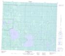
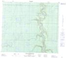
Maps showing Pelican River, 79-17-W4, Alberta
Pelican River is a River located in 79-17-W4, Alberta and has an elevation of 559 meters.
- Latitude: 55° 50' 10'' North (decimal: 55.8361111)
- Longitude: 112° 38' 39'' West (decimal: -112.6441666)
- Topography Feature Category: River
- Geographical Feature: River
- Canadian Province/Territory: Alberta
- Elevation: 559 meters
- Location: 79-17-W4
- Atlas of Canada Locator Map: Pelican River
- GPS Coordinate Locator Map: Pelican River Lat/Long
Pelican River NTS Map Sheets