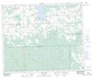
Maps showing Pendryl, 15-46-5-W5, Alberta
Pendryl is a Unincorporated area located in 15-46-5-W5, Alberta and has an elevation of 944 meters.
- Latitude: 52° 57' 38'' North (decimal: 52.9605555)
- Longitude: 114° 39' 12'' West (decimal: -114.6533332)
- Topography Feature Category: Unincorporated area
- Geographical Feature: Locality
- Canadian Province/Territory: Alberta
- Elevation: 944 meters
- Location: 15-46-5-W5
- Atlas of Canada Locator Map: Pendryl
- GPS Coordinate Locator Map: Pendryl Lat/Long
Pendryl NTS Map Sheets