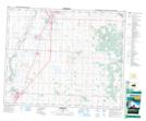
Maps showing Pennington Lake, 34-36-28-W4, Alberta
Pennington Lake is a Lake located in 34-36-28-W4, Alberta and has an elevation of 904 meters.
- Latitude: 52° 8' 31'' North (decimal: 52.1419444)
- Longitude: 113° 55' 9'' West (decimal: -113.9191667)
- Topography Feature Category: Lake
- Geographical Feature: Lake
- Canadian Province/Territory: Alberta
- Elevation: 904 meters
- Location: 34-36-28-W4
- Atlas of Canada Locator Map: Pennington Lake
- GPS Coordinate Locator Map: Pennington Lake Lat/Long