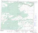
Maps showing Moonshine Lake, 31,32-79-8-W6, Alberta
Moonshine Lake is a Lake located in 31,32-79-8-W6, Alberta and has an elevation of 718 meters.
- Latitude: 55° 53' 11'' North (decimal: 55.8863888)
- Longitude: 119° 13' 40'' West (decimal: -119.2277777)
- Topography Feature Category: Lake
- Geographical Feature: Lake
- Canadian Province/Territory: Alberta
- Elevation: 718 meters
- Location: 31,32-79-8-W6
- Atlas of Canada Locator Map: Moonshine Lake
- GPS Coordinate Locator Map: Moonshine Lake Lat/Long
Moonshine Lake NTS Map Sheets