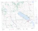
Maps showing Sunset Hill, 21,28-40-2-W5, Alberta
Sunset Hill is a Mountain located in 21,28-40-2-W5, Alberta.
- Latitude: 52° 27' 51'' North (decimal: 52.4641667)
- Longitude: 114° 13' 47'' West (decimal: -114.2297221)
- Topography Feature Category: Mountain
- Geographical Feature: Hill
- Canadian Province/Territory: Alberta
- Location: 21,28-40-2-W5
- Atlas of Canada Locator Map: Sunset Hill
- GPS Coordinate Locator Map: Sunset Hill Lat/Long
Sunset Hill NTS Map Sheets