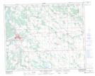
Maps showing Blueberry Creek, 27-39-4-W5, Alberta
Blueberry Creek is a River located in 27-39-4-W5, Alberta and has an elevation of 1001 meters.
- Latitude: 52° 22' 49'' North (decimal: 52.3802777)
- Longitude: 114° 30' 13'' West (decimal: -114.5036111)
- Topography Feature Category: River
- Geographical Feature: Creek
- Canadian Province/Territory: Alberta
- Elevation: 1001 meters
- Location: 27-39-4-W5
- Atlas of Canada Locator Map: Blueberry Creek
- GPS Coordinate Locator Map: Blueberry Creek Lat/Long
Blueberry Creek NTS Map Sheets