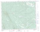
Maps showing Flare Creek, 8-37-9-W5, Alberta
Flare Creek is a River located in 8-37-9-W5, Alberta.
- Latitude: 52° 10' 17'' North (decimal: 52.1713889)
- Longitude: 115° 15' 4'' West (decimal: -115.2511110)
- Topography Feature Category: River
- Geographical Feature: Creek
- Canadian Province/Territory: Alberta
- Location: 8-37-9-W5
- Atlas of Canada Locator Map: Flare Creek
- GPS Coordinate Locator Map: Flare Creek Lat/Long
Flare Creek NTS Map Sheets