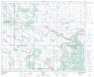
Maps showing Armstrong Hill, 27,28-44-8-W4, Alberta
Armstrong Hill is a Mountain located in 27,28-44-8-W4, Alberta.
- Latitude: 52° 49' 30'' North (decimal: 52.8250000)
- Longitude: 111° 5' 33'' West (decimal: -111.0924999)
- Topography Feature Category: Mountain
- Geographical Feature: Hill
- Canadian Province/Territory: Alberta
- Location: 27,28-44-8-W4
- Atlas of Canada Locator Map: Armstrong Hill
- GPS Coordinate Locator Map: Armstrong Hill Lat/Long