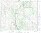
Maps showing Curly Hill, 30-43-8-W4, Alberta
Curly Hill is a Mountain located in 30-43-8-W4, Alberta.
- Latitude: 52° 44' 18'' North (decimal: 52.7383333)
- Longitude: 111° 8' 33'' West (decimal: -111.1425000)
- Topography Feature Category: Mountain
- Geographical Feature: Hill
- Canadian Province/Territory: Alberta
- Location: 30-43-8-W4
- Atlas of Canada Locator Map: Curly Hill
- GPS Coordinate Locator Map: Curly Hill Lat/Long
Curly Hill NTS Map Sheets